TAMPA, Fla. – Hurricane Polo is moving along Mexico’s coastline as a powerful 155 mph storm, while a separate Atlantic system threatens to bring heavy rain, strong winds and severe coastal erosion to the Northeast this weekend.
Read more Tampa Bay Rays unveil fan-voted road jerseys ahead of Yankees matchup
Pacific storm track
What we know:
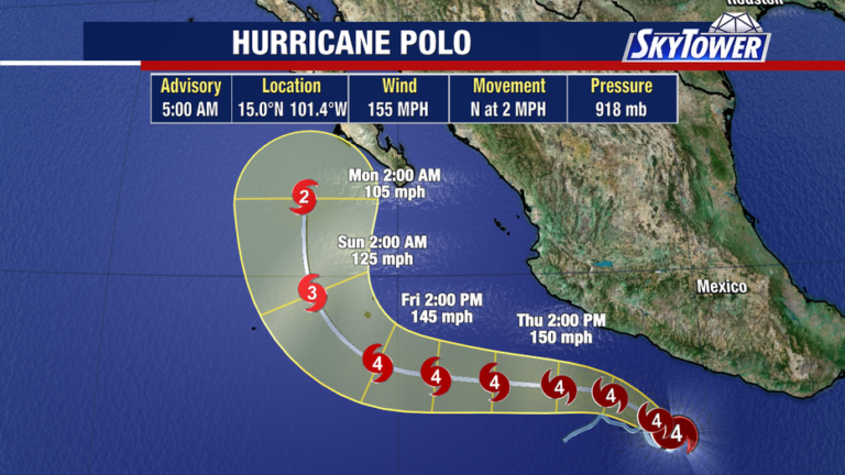
Hurricane Polo rapidly intensified in the Eastern Pacific, reaching maximum wind speeds of 180 mph at its peak. The hurricane currently holds maximum sustained winds of 155 mph, keeping it just shy of Category 5 strength. Forecasters expect the storm to travel along the Mexican coastline before potentially tracking toward Baja California early next week as a minimal hurricane.
Northeast coastal impacts
What we don’t know:
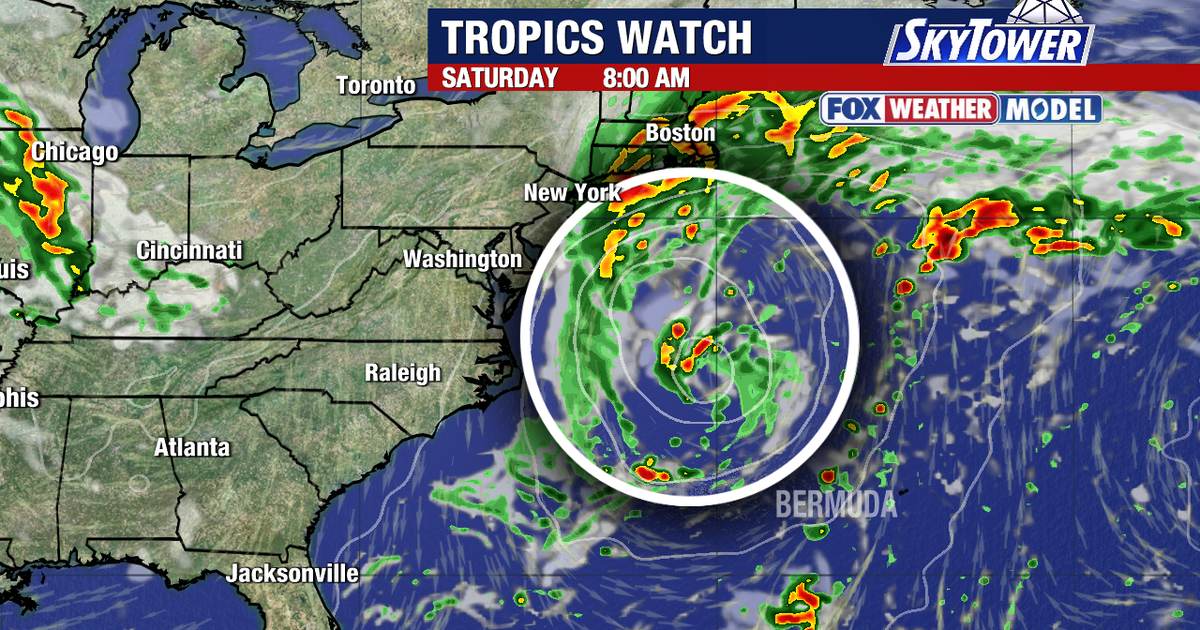
Meteorologists are closely tracking an offshore area of low pressure expected to form off the mid-Atlantic coast before moving toward New England over the weekend. Weather models disagree on the exact path, with some pulling the storm system directly onshore while others keep it farther out to sea.
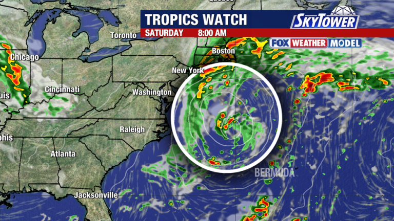
Regardless of the track, coastal communities face threats of heavy rainfall, gusty winds, storm surge and coastal beach erosion.
Read more Hayden Panettiere’s cause of death confirmed by officials
Atlantic ocean forecast
Big picture view:
Activity in the Atlantic basin remains far less threatening to land compared to the Pacific.
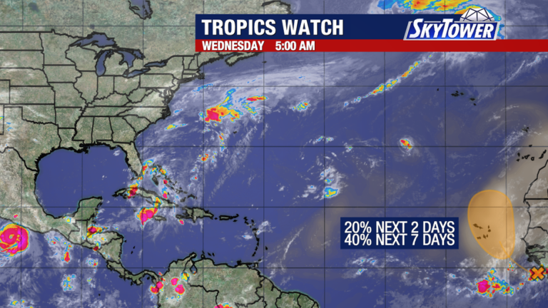
A tropical wave off the African coast has a 40% chance of developing into a named storm over the next seven days. Computer models show that system turning almost due north over the Cape Verde Islands, keeping it safely away from populated landmasses.
About the Author