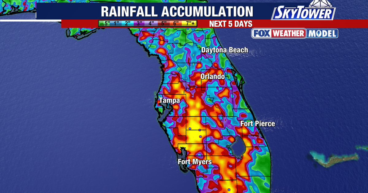
TAMPA, Fla. – Scattering downpours will bring heavy rain along and west of Interstate 75 over the next few days as an active summer pattern persists across the region.
Read more Dolly Parton’s ‘Life of Many Colors Museum’ and ‘Song Teller Hotel’ to open Sept. 29 in Nashville
Regional storm activity update
What we know:
Inland communities recorded between 3 and 6 inches of rainfall over the past week, creating solid water totals across interior areas. Coastal locations received far less precipitation during the same stretch.
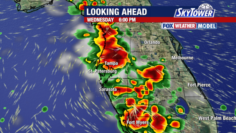
Forecasts indicate that upcoming afternoon and evening scattered storms will concentrate primarily along and west of Interstate 75.
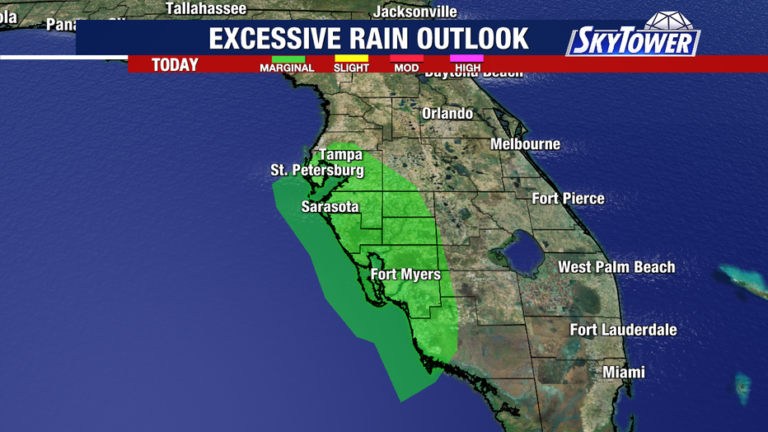
Some localized storms could produce intense, excessive rainfall within a brief timeframe, increasing the risk for sudden localized flooding.
Read more Look up to see the ISS using NASA’s ‘Spot The Station’ app: Here’s how
Tropical weather pattern monitoring
What we don’t know:
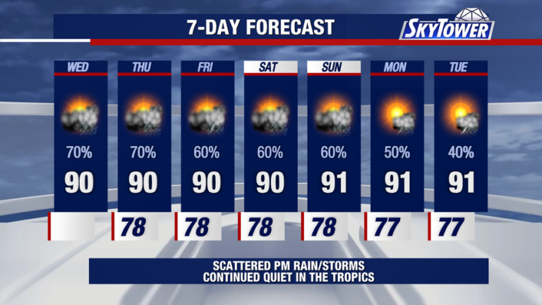
Meteorologists are tracking calm conditions across the basin even though the Atlantic calendar has reached the peak of hurricane season.
It remains uncertain when tropical development might resume as the quiet streak persists.
Read more Poll finds Americans fear domestic extremists more than foreign threats
About the Author